Type: Vintage Style / Historic
Programs used: ArcMap, Adobe Illustrator, Adobe Photoshop
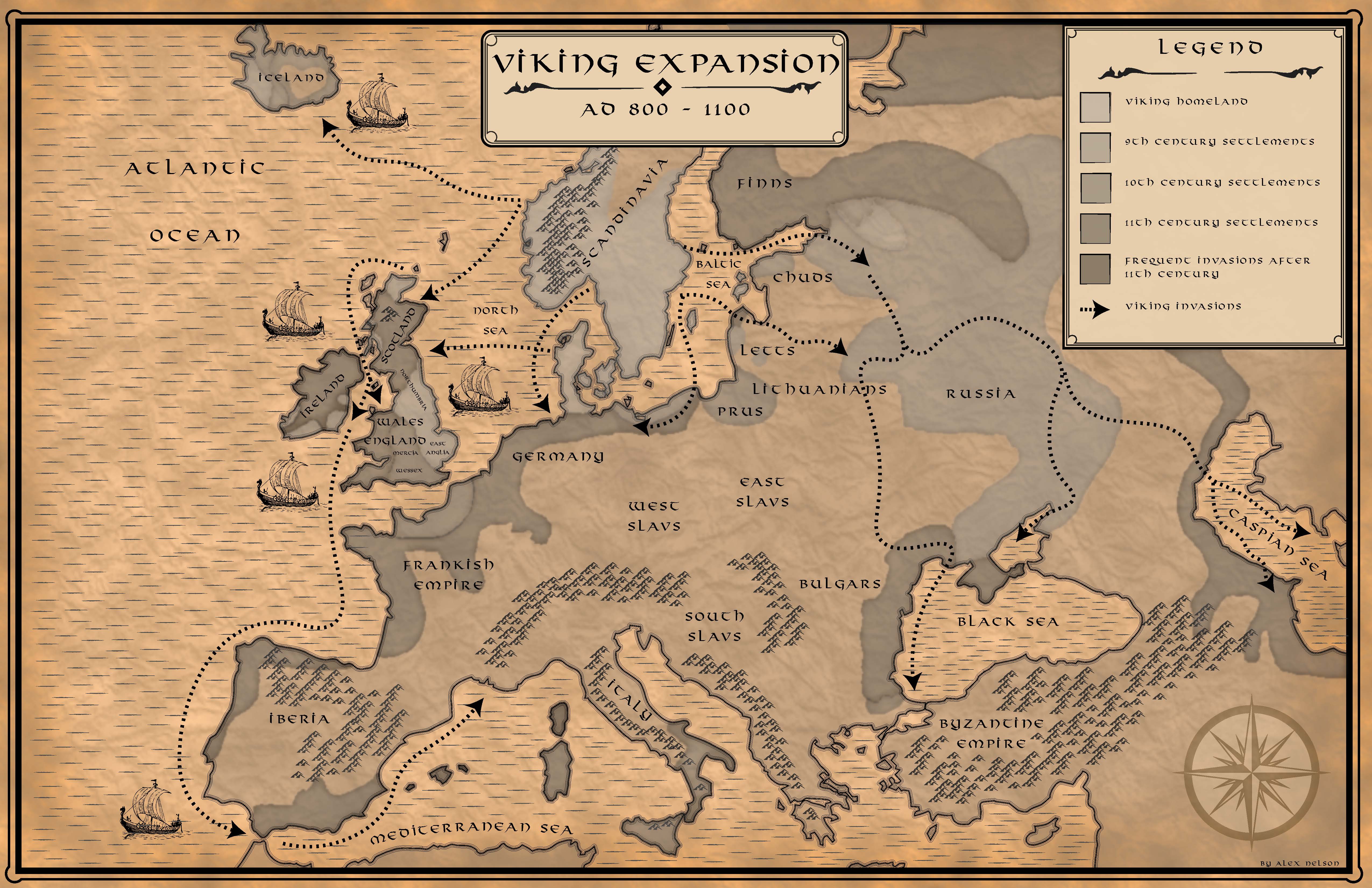
Description: An old paper texture was applied to a blend of brown hues to create a vintage style paper to provide a backdrop and a vintage feel for the map. Brush strokes were used for the water features. The dotted arrows and grey water-color-like hues help to show the path as well as locations that the Vikings traveled and settled in during their historic expansion. Each grey hue (see legend) represents the century that that area of land was taken over by the Vikings. The map helps to tell a story of the progression of land taken over during the Dark Ages.
Please click on image to zoom view